Saturday, April 25, 2015

Manifest Destiny


Saturday 25 April  -  Scrapped today’s original plan in favor of something we saw on the way to the campground last night.  Those of you who are “mature” enough to remember the TV series “Broken Arrow” know that it was the sanitized story of the famed Chiricahua Indian Chief Cochise, and Tom Jeffords, the local Agent who was the intermediary between Indian Tribe and US Government.  What you probably don’t know is that much of the story took place (in real life) at Fort Bowie Arizona,  (and no, none of my relatives were there), about 30 miles from our last night's campground. 

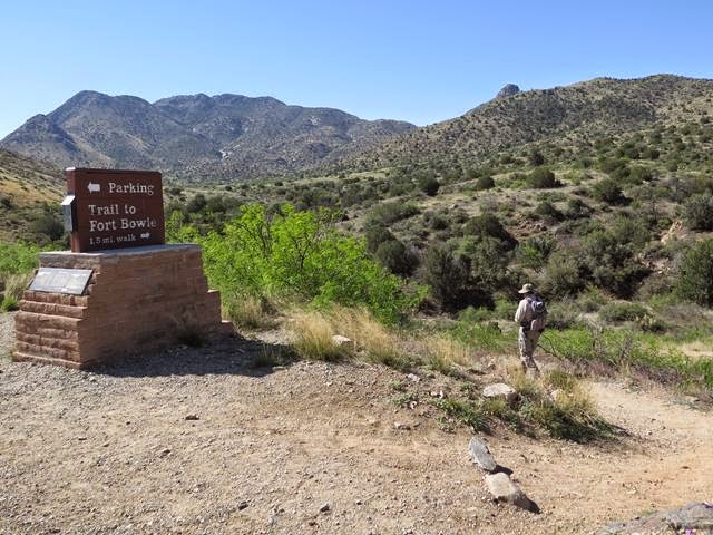
So today, we’re headed to Fort Bowie National Historical Site.  The trailhead to the site is a scenic 10 mile drive up the dirt Apache Pass Road into the Chiricahua Mountains.  

From there it is a short 1.5 mile hike up through hilly Arizona desert country to the remains of what was a large Army Post located in a high isolated valley.


The back story is that in the 1861 Cochise was believed to have been involved in a wagon train massacre and the kidnapping of a small boy from near this location.  He was arrested by the Army and escaped, but 6 others of his band were summarily executed.  This was the start of a 10-year war for control of Apache Pass, through which the famed cross-country Butterfield Stage Road ran, and in which existed the only natural spring in the area. (It was later proved that another band was actually responsible for the massacre.)

The trail first takes you up the valley past the ruins of the stage station and the faint track of the stagecoach road, the primary purpose of the fort being to protect immigrants passing along that route.


A bit further along is the cemetery where those who perished in the pass from natural or (more often) unnatural causes, were interred.  Many headstones were simply marked “Killed by Indians”, names lost forever to history and to loved ones.


As we near the site of the fort, we pass Apache Springs.  The small trickle of water flowing over a rock ledge must have looked like the fountain of youth to any passersby of that early era.  Even after the short distance we’d hiked so far, it was an inviting sight.


Above, on top of a small hill overlooking the spring, stands a low stone wall where the first defenders of the spring set up camp prior to the building of the more substantial post a year later. It would have been a pretty miserable place, completely open to the elements, as well as to fire from those who owned the hill before.

Just up the trail from the spring is the foundation of the “Agency Building” occupied by Tom Jeffords during a later period when an uneasy peace replaced the long violent conflict.  (Probably the time-frame of the TV show.)

By this point we (I anyway) are immersed in the story and the place.  Nothing is physically changed from 150 years earlier when the next breath you took may have been your last.


At the end of the trail, is Fort Bowie.  A large American flag raised above the parade grounds surrounded by 40 or 50 acres of what would be barracks, corrals, store houses, officers quarters, a hospital and even a tennis court.  The fort in its prime was very large and would have been home to several hundred troops as well as some of their dependents and other civilians.  After its abandonment in 1894, what remains is only adobe walls and foundations.  But it takes little imagination to picture what would have been a busy frontier military community.


On the recommendation of the resident ranger, we take a different return route up a steep rocky trail to a ridge overlooking the entire valley. There is a forest of bright red flowered ocotillo on an otherwise drab hilltop, and the “brisk” 30 plus mph wind is actually welcomed, canceling out the rising afternoon temperatures.


For anyone who is a history buff, I’d highly recommend this as one of the best sites I’ve visited over the years.  Although the fort site is fairly small, it is tucked into a corner of a huge and beautiful landscape that was critical to development (good and bad) of the American West.

By now late afternoon, we head for Catalina State Park, north of Tuscon (with a stop at Olive Garden).

So Goodnight From Tuscon

Brad and Val


Friday, April 24, 2015

One More "A Kinfolk" Post (Last One - I PROMISE)

Friday 24 April

At 4 am on 9 March 1916, Pancho Villa invaded the United States and launched a raid on Columbus New Mexico, robbing and looting and killing  10 civilians as well as 8 soldiers of the US 13th Cavalry K Troop.  It so happens that Captain Higbee Davidson commanding E Troop of the 13th had just a few months earlier moved his Troop from Columbus to Alpine Texas as mentioned in yesterday's blog post.

As a result of the raid Higbee and the rest of the 13th Cavalry were in the lead several weeks later when several thousand US Army troops departed Columbus and invaded Mexico in pursuit of Villa.  Higbee spent the next 8 months in Mexico fighting under General George Pershing until somebody decided the "splendid little war"  wasn't so splendid after all and everybody went home.
Since Columbus is more or less on the way to where we are going, it was a must stop for me.  I was a little nervous about the 60 mile road from El Paso to Columbus since it closely parallels the US/Mexican border and is uninhabited and lightly traveled (except by border jumpers and drug runners).  Additionally, in 2012 virtually the entire city government of Columbus, including the police force, was indicted for gun running across the boarder.  As a final straw, Justice Watch just a few days ago reported the following:


"Another ISIS cell to the west of Ciudad Juárez, in Puerto Palomas, targets the New Mexico towns of Columbus and Deming for easy access to the United States, the same knowledgeable sources confirm."

An eerie parallel to what I was going there to see in the first place.


Ruins of Ft Furlong, Columbus NM From Cobbs Hill
Site of the Pancho Villa Raid

After leaving Columbus, (and passing through a Homeland Security Checkpoint), we continued west to our next stop, with an unsuccessful attempt to reach the ghost town of Chance New Mexico.  The Funmobile really isn't built for that.


"Which way do you think?


Finally arrived at Chiricahua National Monument.  The campground was full so the lady said just go back up the road 2 miles and take a left.  Go another 5 miles up a REALLY wash boarded road and camp wherever you-u-u-u want-t-t-t-t.

Not a bad site.
But the road is #$^%
 Good night from just outside of Chiricahua National Monument.

Brad and Val


Thursday, April 23, 2015

Big Bend To El Paso

A travel day today.  On the way we stopped at a local general store in Terlingua TX to fill up on fresh water.  The original plan was to take a local road along the Rio Grande from Terlingua to Presidio TX.  While filling the water tank and getting the life story of a local rancher who lives "a ways down that road", he allows that it's "real purty if ya like the desert" but that about half way along the 50 mile drive there's "the steepest dad-burn hill ya ever seed.".


So.... change of route cause he's driving one of those aforementioned Dodge RAM P/U's and I'm driving a sissy wagon. Nice guy though.


Oddly enough, the revised route takes us through Alpine Texas where, (Oh No, here comes another kinfolk story),  Great Uncle Higbee Davidson, (whose saber hangs upon our home wall), was stationed while he led Troop E of the 13th Cavalry through the hills and canyons chasing Mexican Bandidos and assorted nefarious gringos from 1908 to 1909.  I could almost picture him there.

A cottonwood at Fort Davis parade grounds


A final stop a few miles north of Alpine, at Fort Davis National Monument where once stood... Fort Davis??   From 1854 to 1891, the US (and for a couple of year the Confederate) Army chased essentially the same Mexican Bandidos and gringo bad-boys through the same hills and canyons.

Some things never change I guess.


Anyway, tonight is a hotel night in El Paso for a shower and to catch up on this blog.

Oh... and I almost forgot...


So that's all for now.  Tomorrow we enter New Mexico.

Good night From El Paso.

Brad and Val


Big Bend National Park


Been off grid for several days now in Big Bend National Park so I’ll just do a running post starting at where we left off on Sunday the 19th.  Also just noticed the map isn't working.  Will get it back online soon I hope.

Monday 20 April  - Left Colorado City for the run to Big Bend, the first hurdle being the  40-mile stretch from Midland TX to Odessa TX which happen to be the home of George W Bush as well as about 400,000 Dodge Ram pick-um up trucks belonging to an equal number of decidedly rough looking oil well workers.  And this is just the support center, not the actual oil wells which would probably triple the above numbers, excluding the number of Bush’s.  (Or actually maybe not.)

Anyway, we shortly cut south across the Texas scrubland for Fort Stockton, the last town of any size before the 150 mile run to Big Bend.  There is little of note on this stretch except some pretty fancy yard art outside of Imperial TX, and a “DANGER – POISON GAS” sign posted at the entrance to every dirt side road along the way.  From twinge in my nose, that would be sulfur dioxide from the oil wells.  (Ever try to hold your breath for an hour?  Fortunately even the 2-lane roads are 75  mph.)


Don't Wanna Get Sued (or shot)
Stopped in Ft Stockton for lunch, which we chose based on the number of aforementioned pickups in the parking lot.  I was a tad out of place in my sneaker sandals and REI cargo pants.  (Food was good and with only a mildly upset stomach the following day, my stomach's fault, not the food's.)


The scenery starts to pick up on the final 80 miles to the park having hit the peak of the desert wild flower season with a riot of colors everywhere. 


Ocotillo In Bloom

 Also reassuring (or not) was the presence of a Border Patrol truck hiding behind every mesquite of any significant size.


Was Gonna post a picture of a BP truck but decided
not smart to be stupid so early in the trip.
First choice campground was full so we ended up at a nearby alternate 20 more miles up a dead end road.  Early enough for an evening walk along the Rio Grande. Pleasant weather of 70’s with a light overcast and a good breeze.  In several places along the trail, Mexican made crafts were set out for display and purchase on the honor system.  Left unattended presumably by local residents across the river to avoid being picked up by Border Patrol and transported 40 miles up-river for processing, deportation, and a LONG walk back home..  


Crafts for sale along the trail.   The snake is fake (I think).
End the day was watching a buzzard stalking the absent neighbor’s campsite looking for a free meal.


Good Night from Rio Grande, Big Bend.
======================================================================
Beep Beep!!

Tuesday 21 April  -  Up early with the morning doves.  (I hear they are tasty).  Also a road runner poking around our site.  Ate breakfast at a desert overlook on the drive back to our original preferred CG and some hiking in the Chisos Mountains Basin area.  Snag an awesome site just as someone else is leaving in the morning.


View out the back window at our new campsite.


Today’s itinerary is a 4 hr (for us) hike from the campground to "The Window" which where all of the water from this high basin exits at a several hundred foot high “pour-over” waterfall.  (However, it being a desert, there is no water, so it’s just a really nice hike through the canyon.)


I leave Val at the trailhead for a few minutes “nature stop” and return to find her mumbling something about a $^!#&;$?  #$%&$!?  BIG snake that just slithered across the entrance to the trail.  Since I wasn’t there to verify, it doesn’t count.

The next encouraging sign (literally) instructs you on how NOT to get eaten by any of the two dozen mountain lions and the occasional bear that inhabit the area.  Essentially it says DO NOT RUN, pick up small pets, look big (???), yell, and throw rocks, (and presumably the aforementioned small pets).  I already knew this so I was prepared with Val’s favorite flavor of bear spray.  Fortunately none of that info, nor the bear spray, was required and we had a quiet, uneventful hike.


Snakes?   Pftttt.  Bring Um On!


NO!  I'm NOT backing up one more step.

End Of Day.   Lots of stars tonight along with a crescent moon right next to Venus??

Good night from Chiso Basin CG.

Brad and Val
=============================================================
This Wasn't The Working One

Wednesday 22 April – Up early and a short run down the road to turn on the generator for toast and coffee.  (No generators allowed in the CG.)  Drive south for about 40 miles to the far south end of the park.  A couple of short hikes along the way.  One to an abandoned homestead in the middle of nowhere.  There was still a working windmill with running water, making a small oasis of shade trees around the adobe estancia foundations.


A little further down the road, a fairly deep wash with some interesting geology and some interesting lizards.  (I'm pretty sure you're going to see LOTS of lizard pictures before this trip is done.)  


Didn’t go very far as there was some overcast and the debris from past flash floods was well up the sides of the walls.

Lunch outside a general store in Castolon, a “town” little changed since the early 1900’s. (Except for the fact that they had Blue Bunny ice cream sandwiches in the little freezer.)


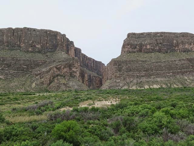
Eight miles further to the goal of the day, Santa Elena Canyon, where the Rio Grande has cut a slot through a massive limestone uplift creating a narrow canyon with 1,200 foot shear walls on both sides.  You can hike a ways into the canyon with the trail ending on sandy beaches before the walls drop straight into the river with no shoreline.  A perfect end to a pretty warm hike.


OK - So Who's Carrying Me Back


Back to Chisos for another night and tomorrow on to El Paso for the start of the next leg of the trip.

Good night again from Chiso Basin

Brad and Val


Sunday, April 19, 2015

Roots

One hundred and thirty-five years ago in 1880, my G-G-Uncle George Davidson and his brother William left the family farm in northern Delaware and set out to find their fortunes in the American West. Along the way, William woo'd and won the love of Blanche, a southern Illinois farm girl, and along she went on the great adventure.  Arriving in Kansas by 1885, the threesome set to work building a business of provisioning the railroad workers opening up track across the prairies.

For reasons unknown, by 1905 they left Kansas for the newly founded southern Oklahoma ranching town of Chattanooga.  This area was in the early stages of homesteading and even though quite remote, hopeful settlers were arriving from points north and east.

William, Blanche and George spent the next 25 years in Chattanooga opening and running a general store where they resided on the second floor.  First George, then William died in 1929 and 1934 respectively and are buried next to each other in Grandfield, a few miles south of Chattanooga.  Blanche relocated to Montana probably glad to be rid of TWO vagabond husbands who dragged her across featureless Kansas then Oklahoma.  (Hopefully Val won't do the same.)  


Only 2-Story Storefont Left In Chattanooga OK
(Pop. @ 400)

Final Resting Place of George and William Davidson
On a small hill overloking Grandfield Oklahoma
(Pop. @  400 before much longer.)
Enough of the history lesson.  This part of Oklahoma is green rolling hills dotted with spring flowers.  Very bucolic.  (Where did that word come from?  Sounds like someone throwing up.)

Anyway, Oklahoma is absolute Eden compared to north Texas.  Pancake flat and covered with scraggly mesquite, this part of rural Texas is pretty harsh, dotted with small dwindling towns with numerous abandoned buildings and homes.  The wellspring of many a country song, to be sure.

Tonight's stop is a nice little state park on a fair sized lake.  Got the place to ourselves almost, and had a nice walk through the cactus garden that is West Texas.


A Desert sprite?
(Or Doctor Pepper?)
Tomorrow to Big Bend.

Goodnight from Lake Colorado City SP, Texas