Monday, May 25, 2015

Happy Memorial Day


Monday 25 May 2015  -  

First of all we wish everyone a wonderful Memorial Day.  Although a serious day of rembrance, it is also a day for families to step back from the craziness of day-to-day career-making and home-making and enjoy just being family.  Since we’ve been off the grid since last Thursday, no one is likely to get this message for a few more days.  But wishing you a good day never-the-less. Wish our family was with us to enjoy this experience.

Since we’ve had nothing BUT good days recently, we were overdue for a “crisis”.  Second only to my coffee maker, the most important piece of technology is the route planning software I used to pin-point all of the interesting, off the beaten track, places to visit.  Well it crashed last night!  For me, that’s like driving with a paper bag over my head.  (Ignoring that I still have 5 other GPS capable devices.  They know where I am, but not where I want to go.)  Working on a solution to that issue.

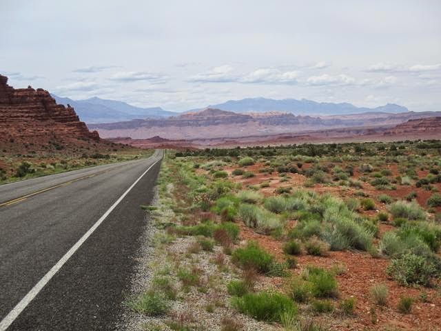
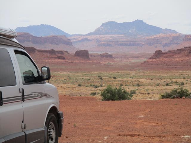
Today’s route took us across more “slick-rock” country to Escalante UT and then down to Kodachrome Basin State Park.  It was here that we encountered another one of those intense SW afternoon thunderstorms with really heavy hail.  Fortunately we had not gone out for an afternoon hike so we just watched the mini-flash flood running down both sides of the funmobile while the hail accumulated.  Good fun.


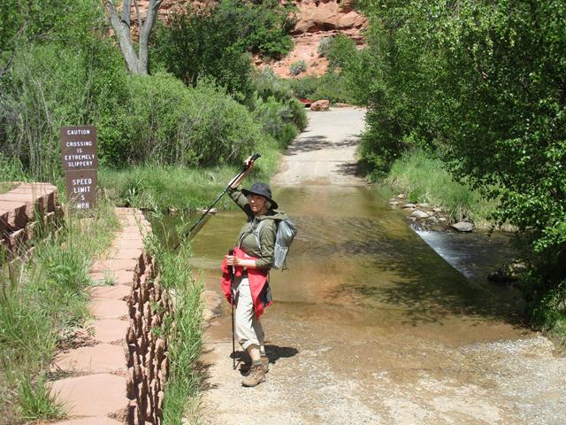
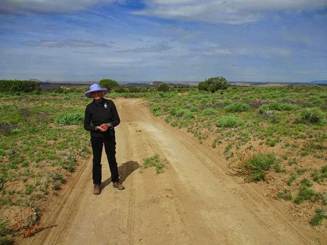
And the sun comes out for a short walk on the nature trail.
And the cactus are liking the moisture.


We're tucked in for two nights and will hopefully hike tomorrow if it dries out a little bit.

Good night from Kodachrome SP UT

Brad and Val

Sunday, May 24, 2015

"It's A Wonderful Day In the Neighborhood" (Music symbol)


Sunday 24 May 2015 

Another good start to the day as I went out to find that we had NOT sunk (sank?) up to our axils in the by now infamous Utah red clay/mud.  The four inch thick plastic leveling blocks however, did sink under the weight of the 10,000 lb Funmobile.  So the morning fun was to dig them out.  The sky is mostly bright blue, and what clouds there are, are the puffy friendly kind.

Back tracking the remaining 10 miles of the Burr Trail into Boulder and then on to Calf Creek Falls Campground and trailhead.  This is a REALLY popular hike in the area so on a Memorial Day we expect a full parking lot.


Calf Creek Canyon from the road in.


On the way through the campground to the trail, we spot one VACANT campsite!  We cash in the lucky rainbow chip and guarantee a place to sleep tonight.  Then off to the trail for the rest of the day.


SHE made me so it again.
Woulda been her fault if I got scorpion or snake bit.


Ghost Dancers?

Trout in Calf Creek
(No calves though)

Almost there.

An EXCELLENT triple drop waterfall.

If you think I'm wading through that COLD water, you're nuts.
CARRY ME
Apparently the lucky rainbow had enough left over change to grant us excellent hiking weather for the whole hike.  So we are back in the Funmobile just as a cloud rolls in and rains for the rest of the evening.

Good night from a good day at Calf Creek Falls and Campground.

Brad And Val

Saturday, May 23, 2015

"Some Day Over The Rainbow...." (Music Symbol)


Saturday 23 May

This morning’s reward for opening one eye at about 6:15 am was a pre-dawn, full rainbow.  I’ve never seen a rainbow before sunrise.  (Probably because I try not to wake up before sunrise, especially when on the road.)  I grabbed the camera and jumped out of the Funmobile to be further rewarded with a VERY cold drizzle down my neck.


If a lucky penny can result in a flat tire, or  a busted Kuerig,
what do you suppose a lucky rainbow can do!

Since it was raining, we took a slow start and topped off with fresh water back at the Park campground. The guy in front of us had one of those 50 foot bus RV’s with what must have been a 100 gallon water tank.  By the time we got our turn, filled up, and made it to the next town it was lunch time.

It was at lunch when I was wining about the crowds we were finding at the park and in town, it dawned on me that this was Memorial day weekend, (which I thought was next weekend).  It was going to be a bear finding a campsite tonight.

Left the lunch place and it was sleeting which promised much fun climbing over the 9,600 pass between where we are and where we wanted to be.  (Jess and Blaine – We drove through 2-Flat-Tires campground for old time’s sake.)  Hit a little sleet up on top, but not bad, then back down to the 5500 ft valley.

The Burr Trail that I mentioned in an earlier blog actually ends near Boulder UT (where we are headed).  The north 30 miles of it is paved so we decide to head down it to find a place to camp, figuring what idiots are willing to drive 30 miles down an effectively dead-end road just to find a campsite.  Well turns out there are lots if idiots (including me) who would do just that.  Most of the dispersed sites were occupied.


Eroded red dirt eroding.


End of pavement.

Hmmm.  Time to turn around.

Yes.  That is my foot.
(Nobody's perfect.)
  
We got to the end of the paved section, plus a little, (do not go on dirt roads around here in the rain), and turned around with hopes the reverse route would reveal something missed on the way in.  We did find a empty site and despite the slightly mushy ground, we set up or the night.  We’ll see just how lucky that rainbow was.  Better than the lucky pennies Val continues to pick up every few days or so I hope.

Good night from 10 miles down the Burr Trail.

Brad and Val

PS - Despite my "occasional" grumbling about this-that-or the other thing, be assured that I'm having the retirement trip I've always dreamed of and am mentally planning a rerun.  (Don't tell Val yet.)

Friday, May 22, 2015

Whoooaaa! Time Warp!

Note - Although prepared and dated 22 May, (the last date we had an internet connection), I'm actually posting today the 27th.  The good news for me is that I will be able to keep track of where we were and when.  The good news for the reader is that I probably (though no promises) won't blather on as much as I try to actually catch up.

Anyway,


 Friday 22 May 2015

Got up “early” to backtrack to Hanksville from Goblin Valley.  Woulda’ stayed for some of what looked to be good hiking possibilities, but its Friday and getting tonight’s campsite at Capital Reef will be a challenge at best.

Last Night's Campsite
(A little short on services, but a great view.)

The view is decent, but no place to set up for quilting.
And it would be impossible to keep the floors clean.

Arrived at Capital Reef and sure enough, by 10:30 am, the campground was already full.  No Plan B, so we’ll just go take a hike and figure it out later.  The hike is Called Grand wash and runs 3 miles or so down a (currently) dry canyon.  Sky is full of puffy white clouds so no immediate rain likelihood.


Guy at trailhead "4-wheeling" in slick-rock country.
Something for everyone.


Tourist!  Etchhhh.


That little spec on the trail next to the big rock is Val

Hope it stays up there til we get through.

Makes you feel a little insignificant.


Really nice hike through the canyon and even though clouds were thickening for the return trip, there a plenty of routes to high ground.  In the worst case, you might spend a few hours for the water to recede, or even an overnight.  No matter how short the hike, I plan for an overnight.  It means hauling around way too much water and clothing layers, and granola bars, but lugging a pack is good exercise I suppose.

Anyway, the CG was still full on the way out so we located a nice dispersed site about 20 miles away.

So good night from N38.1655°, W111.0901° (Cottonwood Wash)

Brad and Val

Thursday, May 21, 2015

Travel Day

21 May 2015

The original plan for today was to ferry across Lake Powell to Bullfrog and try something call the Burr Trail which is a back road across the Escalante Escarpment, a large region of slick-rock canyons.  This is a short-cut to Bryce Canyon that adds about a day to the run.  On three different trips through this area in the past 3X years, I've been on the verge of attempting this route, but was never equipped to wait a few days for help if not successful.

On inquiry to a local who seemed familiar with the route, he just snickered and said "Try it if you want, but don't expect to have a front or rear bumper at the end, assuming you don't just slide off the side of the switchback climb out of the canyon before you even get to the end.

OK - Plan B which was a whimpy but beautiful drive from Halls Crossing to Hanksville, through 130  miles of classic canyon country, with nary a town in between except Hite and Fry Canyon, which as far as I could tell, together, have a population of approximately zero.  (To be honest, Halls and Hanksville barely qualify as "towns"either, but we did spot moving humans.)

Stopped at ruins we spotted on the way to Halls yesterday.


Lunch Break

Boat Ramp to Lake Powell at Hite, UT
(Notice that there is no water at the end of the boat ramp.)
((Hence the previously mentioned population problem.))


On arrival in Hanksville we stopped at "Blondi's World Famous Shakes and Burgers".  Extremely friendly service and outstanding fries.  An extended family of, it looked to be six or seven, owned/staffed the establishment.  The lady owner offered that they just bought it a few weeks ago and she was training sons and in-laws in the essentials of the restaurant business.  We were the only customers at the time so I have to say we got really personalized service.  It'll be a tough startup, but they deserve to be successful.

Good night from a dispersed campsite outside of Goblin Valley State Park.

Brad and Val

Wednesday, May 20, 2015

Just Being a Tourist

20 May 2015

Since we were camped just outside of Natural Bridges National Monument, we decided to just do the park today.  The focus of the park is a deep convoluted sandstone canyon with several very large natural bridges (duh) in the 150' by 200' opening range.

By the time we got into the park and found the trail head we wanted, it was already 12:30.  We decided to just do the first part of the trail down into the canyon.


That's as close as we're gonna get.
 After touring the rest of the park, we continued west towards Halls Crossing on Lake Powell.  We've been here several times before as the starting point for our Lake Powell house boating trips.  The road is about 50 miles of classic SW canyonlands.


A random road-side ruin.

Gotta do the blind curves slowly.

Good night from the campground at Halls Crossing UT.

Brad and Val

Tuesday, May 19, 2015

KA BOOOOOOOOMMMMM!


Tuesday 19 May 2015

Woke up to thunder boomers this morning, but things looked to be improving so we took off on another back road ruin hunt.  

Bad idea.


RETREAT!
Those aren't little white flowers.

Where is the "hail"-plow?


Skies cleared again about 1:30 so one more try.  Left the Funmobile parked next to a paved road and walked a mile or so down the dirt road to the Bullet Canyon south rim trailhead.  After an hour on the trail I thought the “Ruins” that I’d seen on an old map was bogus.  Then on a large boulder hanging about 50 feet out over the canyon wall was a nicely formed, single room ruin.  This one counts as a “wild” ruin since the ranger we spoke to earlier in the day wasn’t aware of any ruins on this trail.


Natural Bridges National Monument campground was filled up so we’re in a “dispersed” campsite a few miles down the road.  Jessica might remember “Bears Ears Road” from meeting up with us on a 90’s trip.

Now I know how it got its name.

Ain't No Dog
  
Good night, (and sleeping lightly), from Bears Ears (foot) Road campsite

Brad and Val 

Monday, May 18, 2015

If You're Getting Tired of Ruins - Don't View This


Monday 18 May 2015

Since this part of SE Utah has an extremely high density of early Anasazi archaeological locations, we put four different sites on the agenda as we moved west from Hovenweep.  The first was only a "maybe" because of the clay-base road to get there.  Turns out that it had dried up pretty good so we gave it a try in spite of vague directions.

I ask the little guy, "Left or Right Do You Suppose??"
Don't believe the locals.
They've got a quirky sense of humor.

Glad I paid attention to 3-point turns in drivers ed.


Ended up walking in.
(She's always dressed properly, whatever the occasion.)

(And always one to smell the roses among the cow pies.)

Worth the walk.


Stopped in Blanding (Pop 3,800) for gas.
(You firgure this one out.)

Then on to Butler Wash where two non-publicized ruins (Target and Ballroom Ruins) supposedly existed.  Directions to Target - "Follow the wash a short ways and take a left up a side wash.  Follow this wash to the first slick-rock on the left.  Climb up and over and follow the wash to the ruins."

This looks promising!

Ahhh... Very Nice!

Original finished exterior wall and roof beams.
Unusual.


Another good possibility.
But the wash is narrow and clouds are rolling in.
 Back to the Funmobile and up the road a short ways to Butler Wash Ruins.  These are BLM controlled-access ruins but still worth the short walk.


A skosh windy on the walk back
Settled in for the night.  More of the same tomorrow.

Good Night from Blanding Utah.

Brad and Val