Thursday, May 17, 2012

The Last Leg Home

[BD]


We reluctantly wake up Wednesday morning knowing that it's time to become responsible adults and return home to friends and family who couldn't be with us on this really great trip.  However, not to fear, because we will be able to enthrall them endlessly with over 850 pictures of pretty much everything we saw.


Wind Turbines Provide Some Amusement
You may notice on the above map that there are very few pretty dark green parts on this 1,061 mile trek across Kansas, more Kansas, the last of Kansas, some of Missouri, and Illinois.  That's because the dark green parts are mountains and forests and parks and such.  There is NONE of that on this route.  In fact, if stood on top of the Funmobile, in Clayton NM, I could probably see the top of the Sears Tower.


Out of shear desperation, we decide to avoid Interstate highways as much as humanly possible on the way back.   As a reward for our perseverance, on some narrow county road north of Hardin, MO, we encountered the most excellent pieces of yard art since the gas pump museum south of Taos.


CORN
In case You Haven't Figured It Out
Our spirits buoyed by this experience and with hopes of yet other gems to be found on the back roads of Illinois...


Good Night From Downers Grove

Tuesday, May 15, 2012

One More Day - PLEASE


[BD]


Another bright, sunny, (but not warm) mountain morning.  The first decision is “just one more day” of New Mexico.  So off we go to Capulin Volcano Nat’l Monument, (E on map) via the back road.  The volcano was just another 360 degree view of endless mountains and valleys. 


Must get a little boring on
the uninhabited mesa tops.
However, the road TO the volcano (squiggly line from C - D on map) was awesome.  (I know.  I use that word to much.)  (I also use () too much.)  A narrow 35 mile, 2-lane pave road through virtually uninhabited mountains, canyons and mesa tops turned brilliant green, (again relative to typical olive-drab), by the prior three days of intermittent rains in the area.


Passed antelope, riders on horseback going who knows where, big entrance gates announcing “Triple J-Bar 7 Ranch”, or some such, with a meandering dirt road disappearing off into the pinion covered hills towards an unseen ranch, (think the Cartwright family of “Ponderosa” fame for those old enough to remember).  Oh, for just a couple of thousand acres of that.


The Folsom Hotel
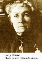
Encountered only a single town, (D on map), which in 1908 was decimated by a flash flood.  The sole active building on the main street of Folsum, (of several abandoned) was a small museum and memorial to Sally Rooke, the local telephone operator who died at her switchboard warning the other valley residents of the approaching disaster.  (The museum was closed, but with a promise to open by calling a number posted on the door and the payment of $1.50)

This night finds us at Clayton Lake NM whose claim to fame is the largest collection of dinosaur footprints in the US.  At the end of a 12-mile drive across featureless grasslands, a sudden drop into a canyon partially filled with a small lake bring us to our small quiet campground.


A short walk from the campsite takes you to the footprints, some of which are easily recognizable as the 3-toed clawed foot of a meat-eater and numerous others (presumably the meat) going in all directions, probably for a very good reason.

It’s now late in the evening and I’ve just been sitting outside looking at the stars which give enough light to see the surrounding hill country.  This is historic cattle country where less than a hundred years ago, real cowboys camped the nights as they drove cows along the nearby Cimarron and Santa Fe trails.  Sitting outside you could close your eyes an almost imagine what it was like, (if you ignore the warm gas heater, hot water shower, and a freshly cooked dinner of salmon patties, boiled potatoes, corn, fruit and the Oreos & milk I had for desert.

Good Night from “home, home on the range”.

Monday, May 14, 2012

Eastward Bound


[BD]


It was a beautiful desert mountain morning, sunny and clear and colder that a well diggers….  whatever.  We decided to take a short hike up the gorge through an area of huge basalt boulders covered with pinion and juniper trees.  Again, classic high desert, volcanic country.


Desert Morning Bug
Desert Morning Flower
Also excellent rock picking country which next to Indian pottery, is one of my favorite things.  (Was almost laughed out of the house at the suggestion that some might buy me a metal detector for my retirement present.)  But the last laugh is mine as I was walking down the trial and saw a bright glint of blue which turned out to be a tiny nugget of turquoise.  (VD says it’s just a mummified blue gummy bear, but what does she know?)

Picking Out Thorns
The walk was great and I came back with pockets stuffed with small rocks for myself, two significant boulders that VD thinks would make great cornerstones for the raised flower bed I promised to build in my retirement, (right after I get my metal detector), and bleeding hands from prying a reluctant cholla cactus from the ground.  I’m sure it will thrive in Downers Grove.

After emergency surgery to stem the hemorrhaging, we’re off to Taos which is a winter kicking off point for New Mexico snow skiers, and a home for the starving artists that would otherwise be homeless in Santa Fe.  Actually a cool little town that would be especially appreciated by any of the readers who might have flirted on the fringes of the 60’s counter culture. 

Another side-note of cultural attitude adjustment  -  While eating lunch at upper end Taos bistro, two ladies of obvious Indian heritage sat down at an adjacent table.  One of the two struck up a conversation with Val (who always look approachable) and before long they are sharing sweet potato fries and chatting up a storm.  At some point, VD sharing that I had not fulfilled my promised to take her country dancing and were might we go to do that.  She could not help us with a local place, as she and her friend were just visiting Taos themselves.  She did however offer the hospitality  of the Jicarilla Apache Nation if we were ever in the neighborhood of of her reservation hometown of Dulce NM, (which we had passed through just a few days earlier).  Val is truly the universal ambassador.

By late afternoon we depart for our final campground night in Cimarron Canyon, of course another picturesque corner of northeast New Mexico.  A small trout stream running through the back of the campsite completes the picture.


Good Night From Cimarron Canyon.

Sunday, May 13, 2012

Better Late Than Never


[BD]

HAPPY MOTHER’S DAY to all you mothers, grandmothers and great-grandmothers out there.  Not very son-like to be off on a grand tour for Mother’s Day.  Will have to make it up when we get back, (now “planned” for this coming Friday).


Fish Jumping Out Of Sand??
Good Thing It Wasn't Freezing Out
Today was a test run to see how difficult it will be to re-acclimate to civilization… so it was off to  Santa Fe, (B on the map).  If you haven’t been there, SF is the cultural center of New Mexico, (of of the world if you believe those who live in SF).  It is a sizeable city complete with an opera, numerous museums, art galleries, traffic and what appear to be a lot of homeless people.  (Probably starving artists.)  It even has a commuter rail line which appears to abruptly end in the middle of empty desert about 10 miles south of city center.

Our first task was to try and find a parking spot for the 20 foot long Funmobile in “old town” with its narrow streets and tight turns.  While I had assumed that Sunday morning would be fairly light traffic in that area, I was dreadfully wrong.  The streets were full of people in their Sunday best absorbing every available parking space and purposefully walking toward the beautiful old Spanish Catholic Church, probably for Mother’s Day Mass.  (Duh – I forgot about that.)

After some circling we finally got parked a ways from the central plaza and walked to the Georgia O’Keefe Museum.  Many of her paintings on display were inspired by the red rock country where she lived just a short ways from the Echo Amphitheater where we had camped 2 nights back.  Val bought only a few post cards so I was let off easy.

Of course we had to return to the car by way of the central plaza with its local Indian artist selling their wares… and OH! look at that great pottery shop.  Though I may complain, I am actually a HUGE fan if southwest pottery,  not to buy, just to look at.  VD is also a huge fan, but without the inhibitions.

So… as we were paying up, BLINK, the power went out in the whole downtown area.  I took it as an omen that white men (or their women) should not buy and remove Native American art from is natural habitat.  Needless to say, I didn’t even bother to offer up that premise and the clerk happily wrote down our credit card number for future completion of the transaction, (only once I hope).

Then off to lunch at some fine bistro.  Oops, no lunch ‘cause no juice.  Most of the remaining high end galleries and shops apparently also closed their doors, probably because of the difficulty of making financial transactions or for security reasons.  So the bad omen turned into a good omen as we found our way back to the car and off to the next campground…..

Fine Arts Museum E
nroute To Campground
….Which is Orillia Verde Recreation Area, (C on the map), a white water rafting mecca in the Rio Grande River Gorge.  Most Bureau of Land Management Recreation areas have the same admonitions posted at the entrances of their camping facilities, No Off Road Vehicles, Quiet Hours 10 pm to 8 am, Max 6 people per site, yadda, yadda.  This one added “No Public Nudity” which gives you a hint of the kind of people who white water raft.

I was observing carefully… and saw none.


Good Night From Orilla Verde.

Brad & Val

Saturday, May 12, 2012

Another Hum-Dinger

[BD]

Departed Echo Amphitheater at {blah-blah-blah}headed for Kasha Katuwe also known as Tent Rocks.  We had seen a post card with some pics of this area back in Nageesi at a trading post and it looked worth a stop. Turned out to be the second most picturesque stop of the trip so far.


Located SW of SantaFe (see map above) this National Monument is cooperatively run by the Cochiti Indians and the NPS. The entrance gate was manned by a local, maybe 15-yr old wearing baggy jeans, big floppy sneakers and a NPS shirt.  To my own discredit, I'm thinking "OK, I'm gonna get skinned here." figuratively speaking.  Of course he was really a great kid, very helpful and with a huge grin.


If nothing else, trips like this help melt away some of the prejudices that get ingrained from watching too may cowboy & indian movies as a kid.


Anyway, as we've come to expect, Tent Rocks was spectacular.  The trail starts out pretty flat and wide with great views of the canyon walls and far away HooDoo's.  After about a half mile, it narrows and climbs slowly into a slot canyon  which is filled with desert foliage as well as some large douglas fir and pines.


It continues to narrow until its single file with walls stretching out of sight overhead..  that's when you start thinking, "Glad its a sunny day."  Pretty soon you break out into a broader section of the canyon filed with the park's namesakes.  Tall cones of rock, many capped by a sizable boulder.  Now the thought changes to "it a bit like a giant's bowling alley where we are the pins."


We continue to climb until we are looking down on the same view that was on the Nageesi postcards.  So of course we take lots of pictures because I was too cheap to buy the postcard.. 


Now the trail takes a decided change to a steep, rocky climb to the summit of the mesa.  We top out to a 360 degree panorama of the New Mexico desert -- and a sizable set of dark clouds you couldn't see from the ascending trail.


We Were All The Way Up THERE?
Being mindful that it's not smart to be the highest thing on the highest peak with an approaching thunderstorm,  we wiki-wiki hightail it off the peak to make room for someone else to be the highest point.  The hike down is pleasant even in the short light rain that followed us for a while.


All-in-all, another absolutely gorgeous hike to end the day.


Then off to the nearby campground to blog the hike and to plan for whatever comes tomorrow.


Goodnight from Kasha Katuwe

Friday, May 11, 2012

Zig-Zag

[BD]

Broken Compass


The original plan upon departure from Chaco (A on map) Wednesday was to head back south to Cuba (New Mexico) and up into the mountains east of Los Alamos.  However, since Chaco had no shower facilities, and we had been 3 days without, we felt it was stretching the relationship a bit to go without for much longer.


So it was north instead to Bloomfield NM (B on map), laundry, a shower and another excellent Mexican restaurant.  Carne Avado (shredded pork) with a sopapilla which I've never had before.  I would describe it as a large flat Crispy Creme,  (the sopapilla, not the shredded pork).  Very tasty and surely good for my cholesterol levels.


Bloomfield is an interesting little energy boom-town.  Lots of oil and natural gas, red dust, roughnecks and hard lookin' women, but all blended together in a pleasant sort of way.  Everyone with a lot of wrinkles and a smile.


Thursday 10 May  -  From Bloomfield, north a short way to Aztec Ruins (C on map).  (They're in the town of Aztec, not built by Aztecs.).  A branch of the same group as Chaco and a similar architectural style.  The big difference here being that the National Park Service mission is educational rather than spiritual like Chaco.

HAH!! - And you snicker
at my GPS


With portions of the first floor of the 2-3 story structure intact, you could get a good sense of what the inside living conditions would be like.Wandering through the labyrinth of passages was definitely cool.


A Note For the Ya-Ya's 


Those Pueblo things ain't
all that tough.
After crawling around the ruins, it's Eastward to Heron Lake (D on map).  A large state park centered on a reservoir with a focus on fishing.  We selected a campground with about 30 sites and since we were the only ones there, we had the best site overlooking the lake at sunset.


Friday 11 May  -  Having completely blown the itinerary (such as it was) by heading north rather than south after Chaco, we wake up not knowing what to do next.  So we just stay in bed and look at the lake.  Eventually we get up and head for a hike down to the Chama River.  


DOWN
UP


Now the laws of geography dictate that in a round trip hike, the vertical distance down into the canyon will be equal to the vertical distance back up to the Funmobile.   Well....  That's a load of "elodes armati" (the afor-mentioned armored stink beetles).  It's at least twice the vertical distance back up.


A good hike never-the-less with a really cool swinging bridge down at the bottom.  Val REALLY likes swinging bridges, especially when I make them REALLY swing.  (Some things guys never grow out of.)


Then we turn south again with a goal of Kasha-Katuwe, (God Bless You).  Drove for about an hour and stopped for lunch at Echo Amphitheater (E on map) just north of ????.  Even though it was only 60 miles from where we started the day, it was so pretty we decided to stay the rest of the day and camp there for the night.  Again only one other camper.


If the weather clears, tomorrow should be another spectacular sunrise on the high canyon walls behind the campsite.


Good Night from ?????.


Brad & Val


Wednesday, May 9, 2012

Its Time To Go

[BD]


Another one-eyed view of the reflected sunrise out the back window of the funmobile.  Followed by another roll-over and go back to sleep, not being ready to face the drive back to Nageezi, (wherever that is.)


So instead we jump on our bikes for a last desert ride, this time to Wijiji ruins.  It's brisk, and the trail starts out a bit sandy for our hybrid bikes, really more suitable for a mountain bike.  But soon we are rewarded for the effort with a riot of desert flowers.  (Keeping in mind that the term is relative to a desert setting that is typically a more drab olive green.)


All this was probably due to last night's showers which were hardly evident back at the CG when we got up.


Again a solitary ride to un-excavated ruins, however this time, the builders never finished the task.  No one knows for sure, but Val speculated that a huge vertical crack in a massive boulder right behind the site may have occurred during construction and was taken as a bad omen.


The recurrent theme of each of our explorations has been the solitude, the beauty and the almost sense of presence of the earlier culture who left us this gift.  It is incredibly difficult to leave.


Good Night Chaco

Tuesday, May 8, 2012

A Walk With Ancients


[BD]

A Tight Squeeze
Today’s journey is a two mile climb to the top of South Mesa to visit the unexcavated Tsin Kletzin Great House ruins.  A fun slick-rock climb with awesome views of the valley below.  Weather was perfect at sunny 60-70 deg with a brisk breeze.

Again, only 4 others were seen on the entire trip.  For most of the time the mesa-top was ours alone.


The Approach to Zin Kletsin
The highlight of the hike was the ruins themselves.  Many of the sites down on the valley floor have been partially excavated to reveal the intricacies of the architecture of the buildings.  Tsin Kletsin is in the original condition as when first surveyed in the early 1900’s.  It presents you with a much more thought provoking scene of 1,000 years of undisturbed antiquity.

The Un-Excavated Site


A bit of poking around in the surrounding sage brush revealed even more intimate evidence of a long lost civilization.  Hundreds, and probably thousands of small sherds of pottery scattered about.  Many intricately painted or textured.  It takes a ton of restraint not to pocket a few of the nicer examples, but aside from the several thousand dollar fine, it would seem wrong to remove even a small piece of history from such a place.


To hold a sherd is like shaking hands with the artist.

Good night again from Chaco